


Capturing the Real-world turn it into digital
OpenCities Planner CONNECT Edition
Cloud-based City-scale Planning and Visualization Service for Digital Twin

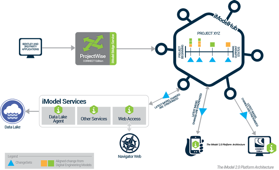
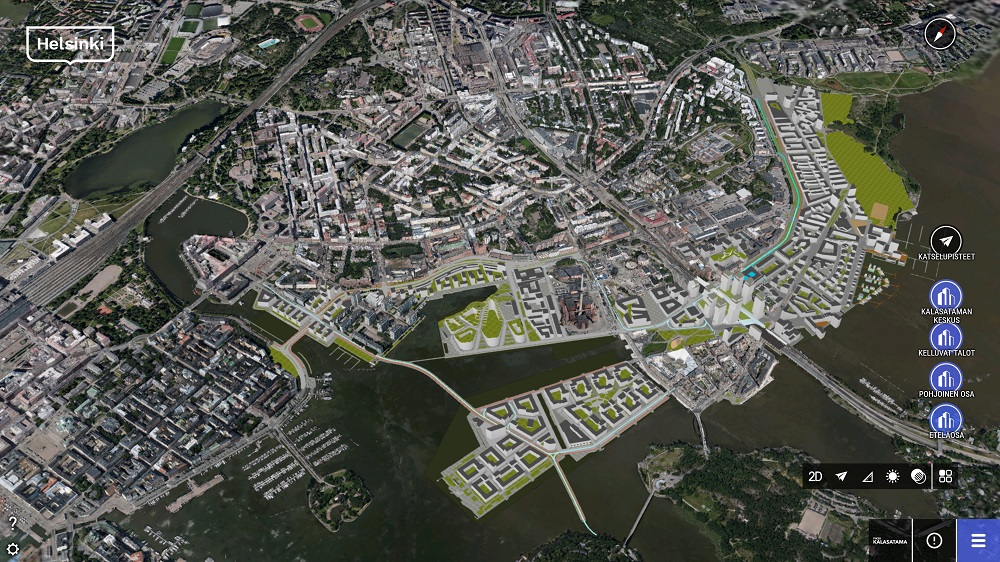
![]() OpenCities Planner CONNECT Edition is a cloud-based service running on a web browser that enables Sharing and Visualization of 2D, 3D, and GIS data in a 3D world.
OpenCities Planner CONNECT Edition is a cloud-based service running on a web browser that enables Sharing and Visualization of 2D, 3D, and GIS data in a 3D world.
OpenCities Planner CONNECT Edition is designed to support Digital Twin.
OpenCities Planner CONNECT Edition can include the following contents.
- Reality models, DTM/DSM, Ortho imagery, 3D city models / 3D models, Point clouds
- Vector data / Shapefiles, Images textured on the terrain (e.g. a plan illustration map)
- Customizable Points of Interests / Placemarks and Details Windows with options to include text, images, attachments, and sharing or embedded websites & videos
- Geospatial forms
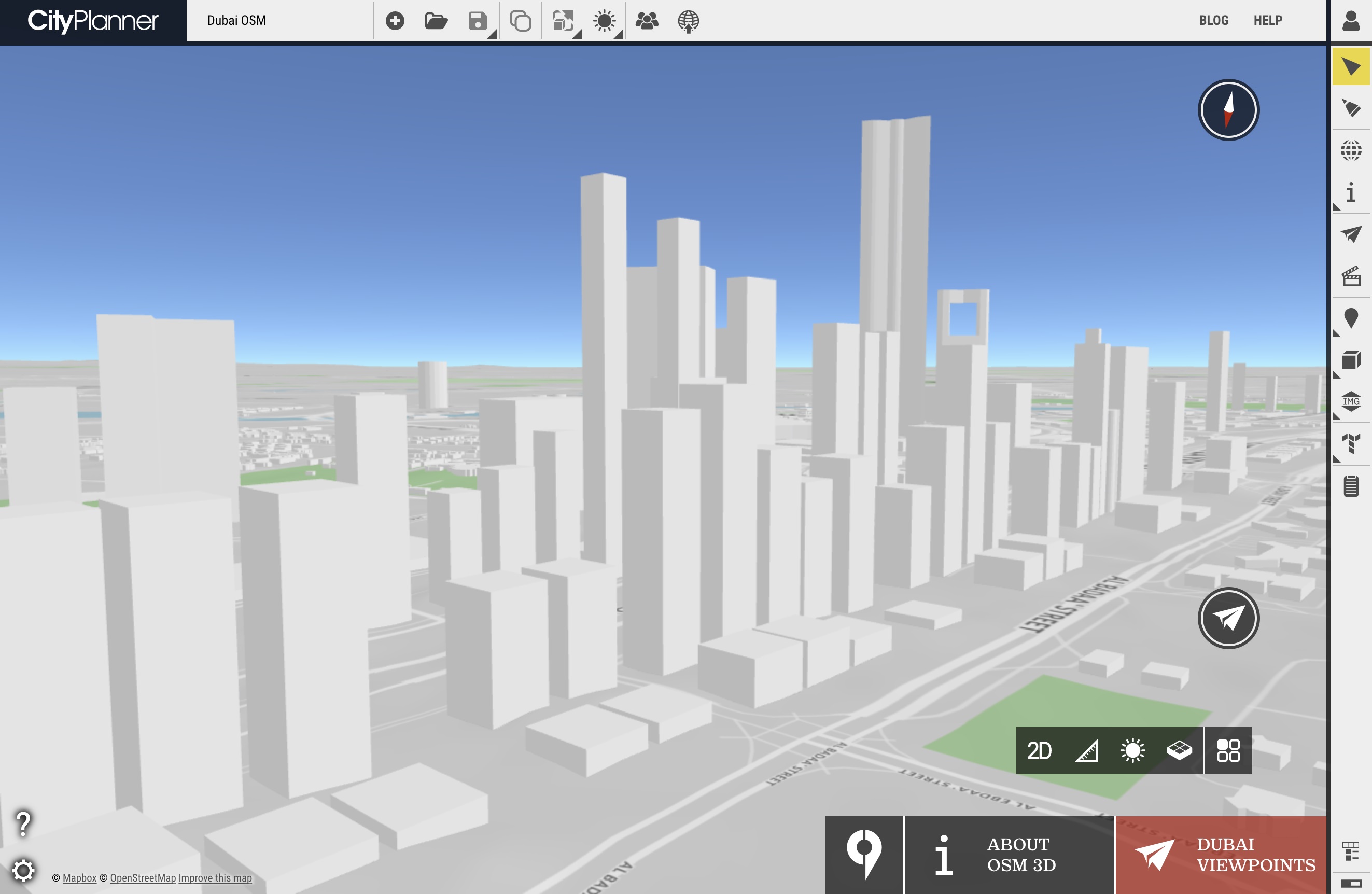
![]() OpenCities Planner Cloud-services has allowed High-quality engineering mesh models depending on size and rendering.
OpenCities Planner Cloud-services has allowed High-quality engineering mesh models depending on size and rendering.
It is recommended to keep your 3D model as small as possible, especially if your project is designed for public publishing.
The number of triangles will impact size and rendering.
*Don't ‘waste triangles on unnecessary details. Textures also have an impact, both size, and resolution.
Size will impact download speed while texture resolution will impact rendering speed.
** Don’t use high-resolution textures unless such detail is required.
*** Try and keep image resolution under 2048×2048
See How to prepare 3D Models for OpenCities Planner
![]() OpenCIties Planner Cloud-Service requires WebGL enable as a web browser.
OpenCIties Planner Cloud-Service requires WebGL enable as a web browser.
Windows Desktop : ![]()
- CPU: i5 or i7 – 4 core 2.5 ghz
- RAM: 8-16GB
- Graphics card: GTX760M or better
- Operating system: Windows 10
- Browser: Chrome/Edge/Firefox
iOS: ![]()
- Device: iPad AIR2 or iPhone6s+
- OS: iOS9 or newer
- Mobile browser, no downloads required
Android: ![]()
- OS: Android Lollipop or newer
- Mobile browser, no downloads required
Using of OpenCities Planner : Here
Video
Capabilities
- Import CAD, GIS, and web services
- Share projects and crowdsource ideas
- Sketch, analyze, and export from 3D cities
- Visualize everything
Import CAD, GIS, and web services
Import detailed 3D models and place them in the 3D world by adding images, vector data, and documents to communicate your project, as well as connect with WMS to add GIS layers to the presentation.
x
Share projects and crowdsource ideas
Invite team members or publish a direct link for public access with just a few clicks by controlling content access based on user roles.
x
Sketch, analyze, and export from 3D cities
Create, visualize, and analyze planning options using 3D modeling and shadow analysis by dragging an object to the map from the 3D library and exporting in 3D to continue detailed design in a third-party BIM or CAD application.
x
Visualize everything
Visualize large-scale projects spanning entire cities down to street level when streaming reality meshes, terrain models, and semantic 3D city models, such as CityGML
x