


Visualization and Reality Modeling
MicroStation CONNECT Edition
BIM-ready 3D Modeling, Advanced CAD Software

MicroStation CONNECT Edition is a 2D/3D CAD and visualization software, MicroStation helps you draft, model, and visualize infrastructure projects of any type, scale, and complexity.
![]()
![]() MicroStation CONNECT Edition functionalities,
MicroStation CONNECT Edition functionalities,
- Produce all deliverables with one application
- Explore more design options
- Integrate any data type
- Ensure and enforce project-specific standards
- Work collaboratively on designs of any size
- Model in a personalized environment
MicroStation - FAQ
- What is MicroStation?
MicroStation is the world’s leading 3D computer-aided design and visualization software for the architecture, engineering, construction, and operation of all infrastructure types.
- Who can use MicroStation?
Architects, engineers, design professionals, and draftsmen can use MicroStation.
From individual professionals to multinational design firms, leading project teams rely on MicroStation to confidently deliver projects, no matter the scale and complexity.
- What benefits does MicroStation offer?
MicroStation is a comprehensive solution.
As 3D CAD software that is used by leading design firms, contractors, and owner-operators around the world,
it provides a range of capabilities: CAD drawing and design, 3D modeling, visualization, component management and mark up, and collaboration across disciplines.
Users can do everything that they need without flipping back and forth through many different applications.
While you don’t need to use the cloud services available within MicroStation, you can use them if you want to advance your productivity and competitiveness.
- Is MicroStation difficult to use?
No. You use the same software to create drawings and CAD files, generate visualizations, reference point clouds and reality meshes, and develop information-rich models.
The technology is flexible enough to meet the needs of every project. It is also simple to build 3D models from 2D drawings.
MicroStation’s CAD capabilities are intuitive and user-friendly, with most users needing weeks rather than months to feel comfortable using it.
Video
Capabilities
- Create project deliverables
- Design in context
- Design with true 3D parametric modeling
- Enforce standards
- Lay out and annotate drawings
- Produce animations and renderings
- Visualize and analyze designs
- Work collaboratively on designs
- Work in a personalized environment
Create project deliverables
Generate consistent, high-quality deliverables such as paper plots, reports, 2D/3D PDFs, i-models, and 3D physical models. Create annotation, display styles, and reports directly from the embedded properties of objects to ensure that they will always remain in sync with the design model during work-in-progress.
x
Design in context
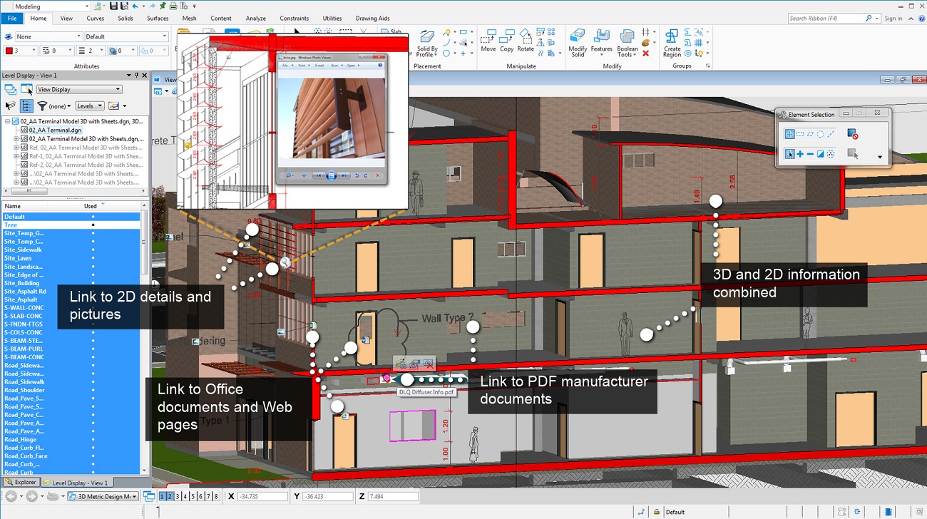
Clearly understand existing conditions and accelerate design modeling workflows with the ability to easily integrate imagery, point clouds, and 3D reality meshes into design and construction models. Integrate geospatial information to ensure that models are precisely geospatially located.
x
Design with true 3D parametric modeling
Develop even the most complex design models with a wide range of design modeling tools, including surface, mesh, feature, and solid modeling. Build parametric functional components with predefined variations to easily find and manage many similar components. Use drawing extraction tools which automatically immerse drawings within models for improved clarity and streamlined documentation workflows.
x
Enforce standards
Ensure the proper application of organizational and project-specific standards and content. Apply templates to control geometry and data standards such as styles for dimensions, text, lines, detail symbols, and more. Once designs are complete, use automated tools to check drawings for standards compliance. Discover how you can manage design changes and drawing standards, and control and protect files.
x
Lay out and annotate drawings
Create precise drawings using a comprehensive set of drafting tools to rapidly progress your designs from concept to completion. Use persistent constraints to maintain your design intent and speed drafting and annotation workflows with intelligent, interactive snapping and dynamic data entry.
x
Produce animations and renderings
Secure stakeholder buy-in by producing realistic movies and simulations from design, construction, and operational models. Choose from keyframe and time-based animation. Get the results you want, faster, using live on-screen animation previews and distributed network processing. Create lifelike visualizations and access online and delivered libraries of physically correct materials, lighting, and rich photorealistic content.
x
Visualize and analyze designs
Understand designs more clearly by analyzing and performing data visualizations on models based on their geometry or underlying attributes. Perform analysis of real-world solar exposure and shading. Apply real-time display styles to visualize models based on each object’s height, slope, aspect angle, and other embedded properties. Visualize reality meshes based on associated spatial and attribute data.
x
Work collaboratively on designs
View and work with design information from others in real time using live referencing of 2D and 3D DGN, DWG, and large image files, refreshed on demand. Create and exchange digital markups of designs. Track and easily understand changes made to design files, even at the component-level, throughout their lifecycle. Improve enterprise-wide collaboration through integration with ProjectWise.
x
Work in a personalized environment
Confidently work in the right context for each project with the required settings and standards automatically applied. Instantly get help and achieve mastery with access to a comprehensive library of learning content. Streamline your workflow and integrate with enterprise systems using a wide range of available tools to customize the user interface including Microsoft (VBA), .NET, C++, C# and user-defined macros. Personalize and group tools and tasks and reduce keystrokes with customizable menus.
x

